
text and photos by Will Yap
A drone’s point of view unveils the island vibes of the city.
From sunrise over Mactan to dusk settling behind the Cebu skyline, this aerial photo essay traces the island’s changing rhythm from above. Bridges, reefs, mountains, and clustered districts reveal a landscape balancing motion and stillness. From metropolis to mountains to shore, Cebu’s narrative emerges through shifting light, measured outlines, and quiet transitions.
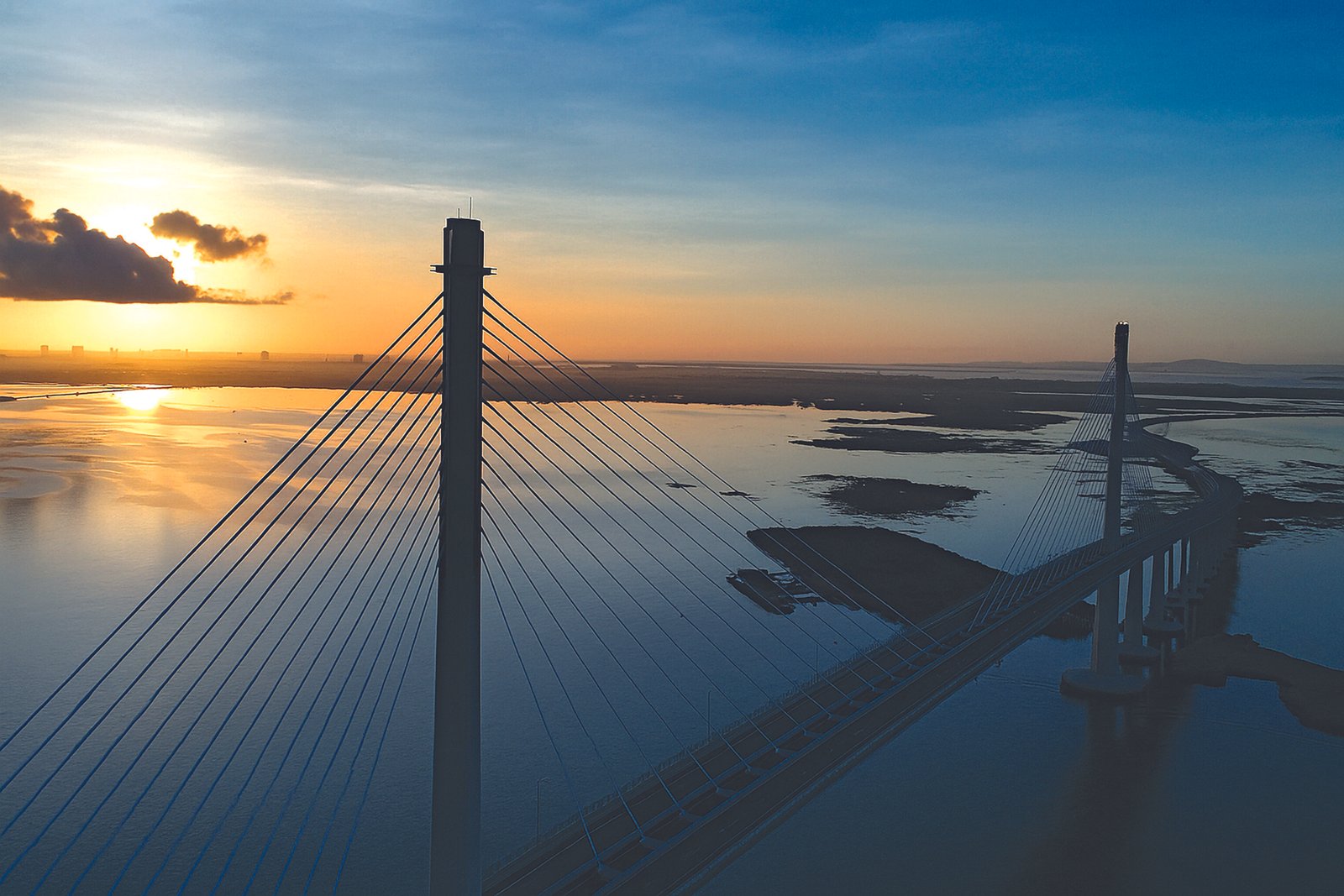
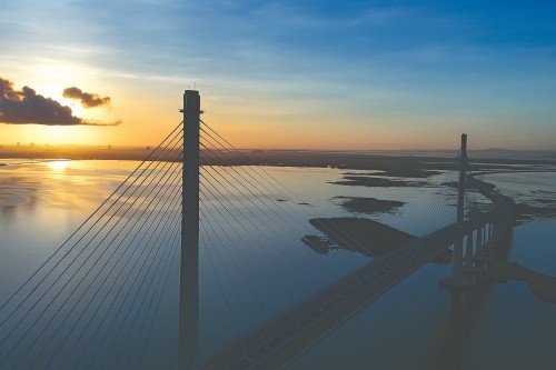
SUNRISE OVER MACTAN AND CCLEX BRIDGE. Sunrise marks a new day that’s still quiet, still peaceful. The early morning sun reflects on the calm Mactan Channel as the Cebu Cordova Link Expressway casts a dramatic shadow.
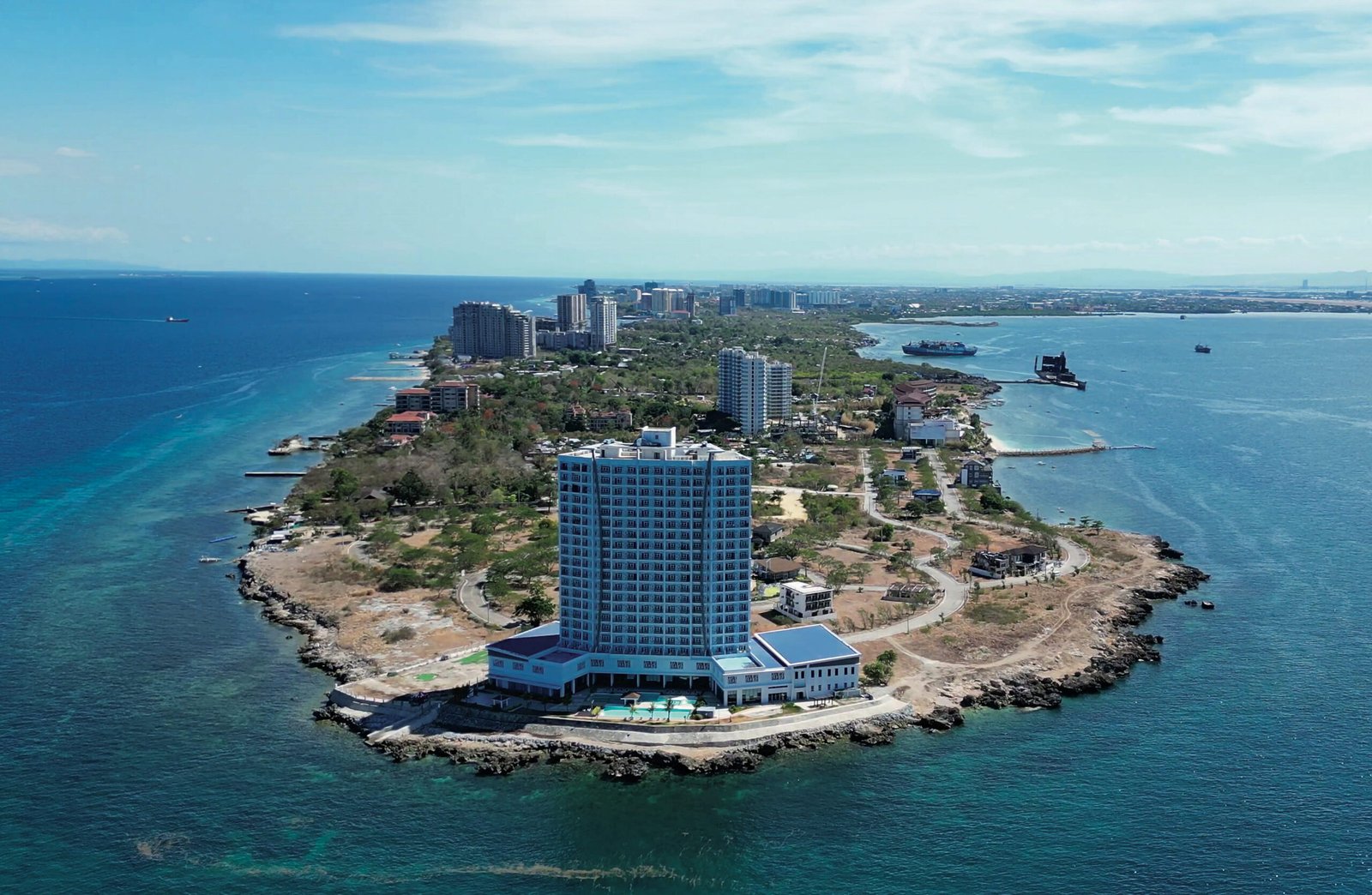
ON THE EDGE. The very tip of Punta Engaño Road, Mactan Island.
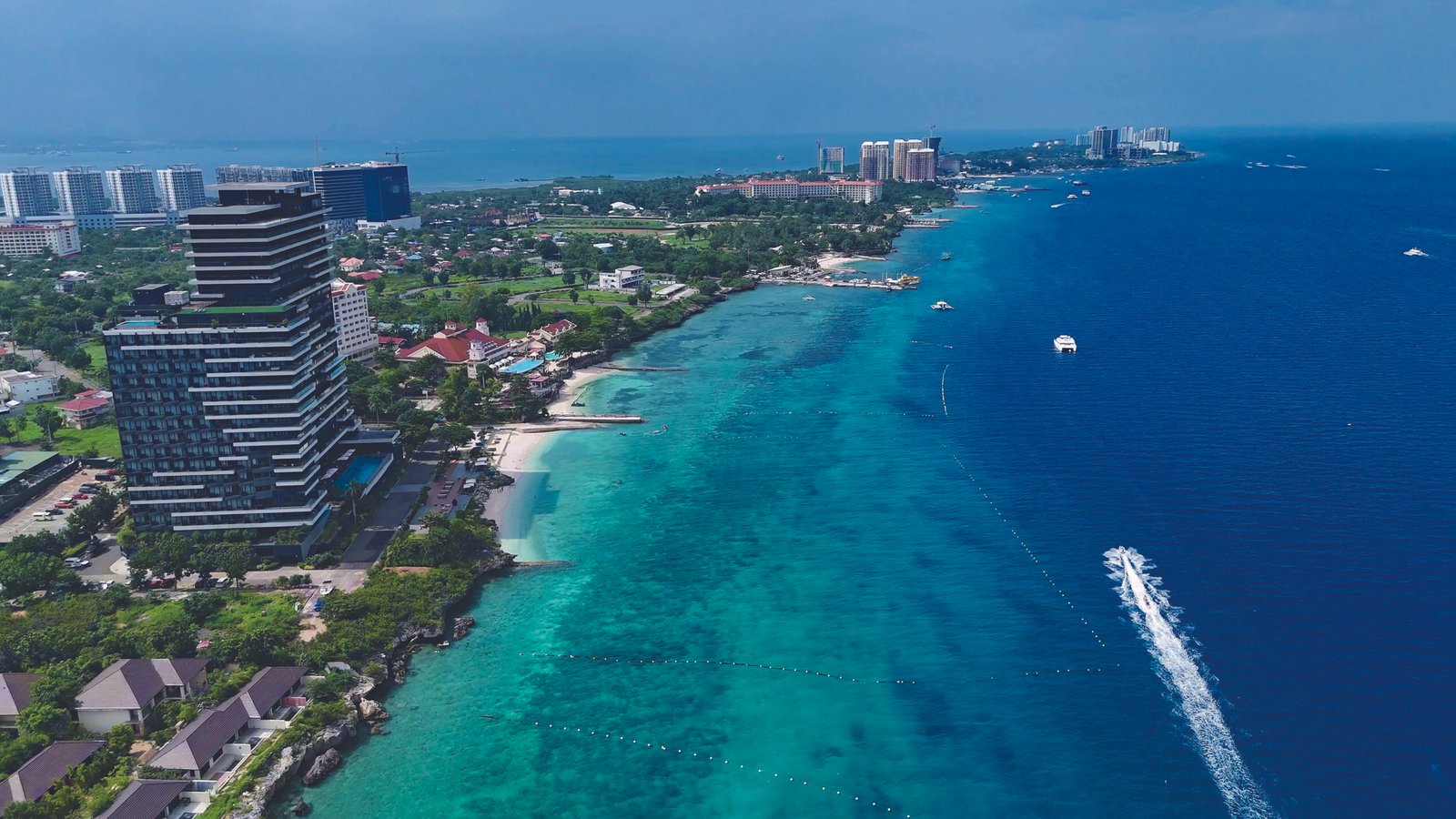
MACTAN ISLAND’S BEACH RESORTS. The higher the sun rises, the more activity there is on Hilutungan Channel. Speedboats, yachts, and other sea craft slice through the water. Resorts come alive as guests enjoy the turquoise waters that Mactan is famous for.
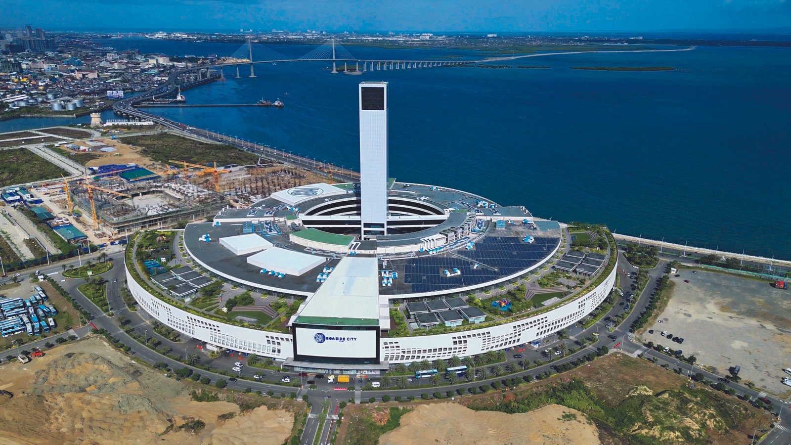
SOUTH ROAD PROPERTIES. One of the largest malls in Asia, and the longest bridge in the Philippines. The largest stadium / concert hall in the Visayas is scheduled for completion in 2026.
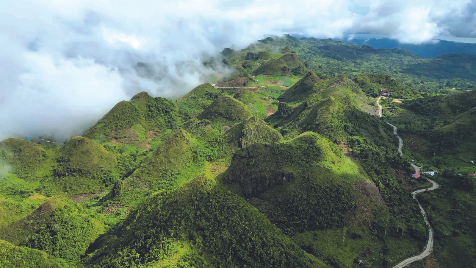
PEAKS AND VALLEYS. Fresh air and calming views from Cebu’s long stretch of green hills and mountains.
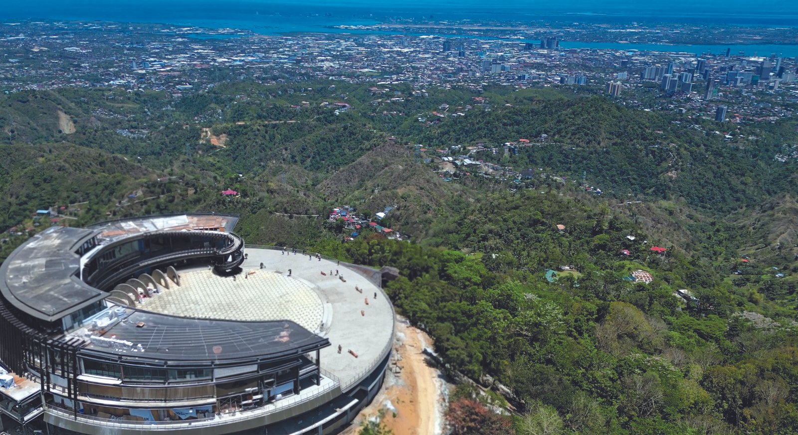
OVERLOOKING. TOPS Cebu is a constant favorite for locals and tourists for its cool air and panoramic views of the city.
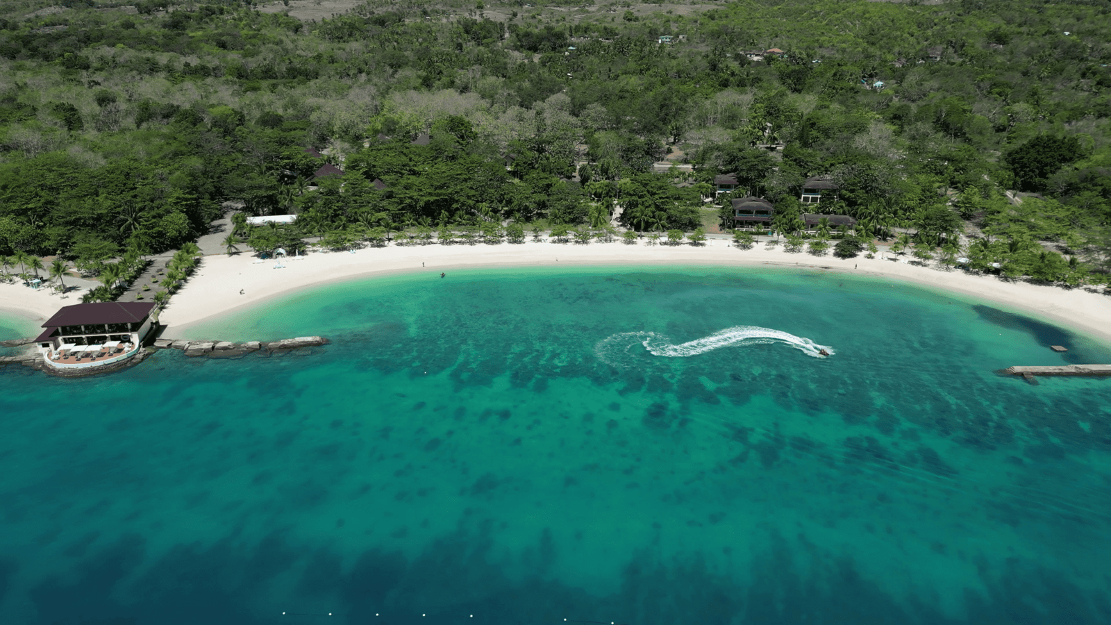
UP NORTH IN EL MAR RESORT. The crescent-shaped beach at El Mar Resort in Sogod
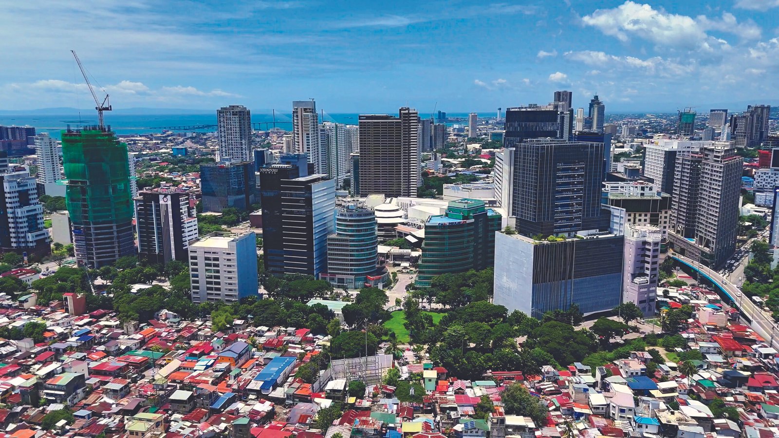
HOMES AND HIGH-RISE TOWERS. A look at Cebu Business Park surrounded by residences.
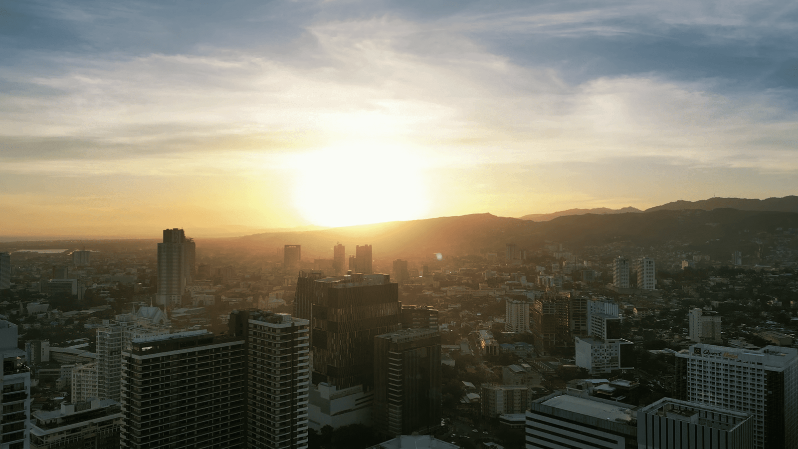
SUNSET. Daylight begins to fade, but Cebu is a city that never sleeps with outsourcing companies operating 24/7/365.